 Book tickets and visits in Rome
 Hotels, B&B and rooms in Rome
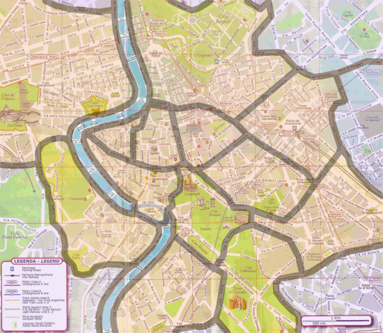
Central districts – Districts outside the walls
Discovering Rome’s Historic Districts
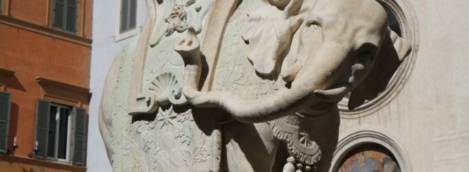
Aventine Hill and Testaccio
 The hill of the Aventine, once populated by the plebeians during the Republic, and later adorned with sumptuous patrician villas in the Empire, is now a peaceful and upscale residential oasis. It hosts a picturesque garden, panoramic views, and the basilicas of Santa Sabina and San Saba on the Little Aventine, as well as the headquarters of the Knights of the Order of Malta. On the other side, Testaccio is a vibrant neighborhood popular among the younger crowd for its lively bars and nightlife (see Aventine Hill and Testaccio district).
Borgo, Prati and Vatican
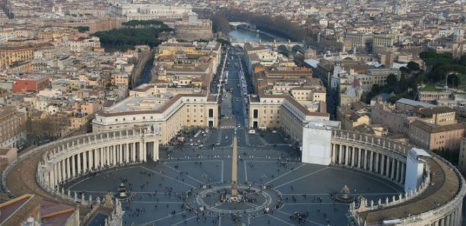
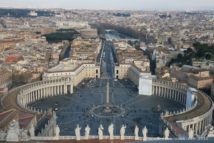
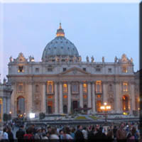 Located to the northwest of the historic center, across the Tiber, Borgo adjoins the Vatican City, renowned for its majestic square and the Saint-Peter’s Basilica, the spiritual heart of Catholicism. Farther north, Prati spreads across a plateau, containing administrative offices, residences, and a plethora of restaurants and nightlife venues (see Borgo, Prati and Vatican district).
Campo, Giulia and Ghetto
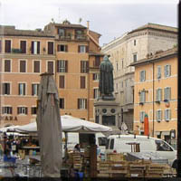 In the heart of Rome, between the Capitoline Hill and the Tiber, this plain—urbanized since Antiquity—was enriched during the Renaissance with prestigious palaces, elegant alleys, and churches around Via Giulia. The lively Campo de’ Fiori square and the picturesque Tiber Island, opposite the charming and still inhabited Jewish Ghetto, complete this historic tableau (see Campo, Giulia and Ghetto district with Tiber Island).
Caelian Hill and Baths of Caracalla
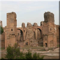 The Caelian Hill, one of the original seven hills, once hosted noble residences, temples, and a barracks. Today, it offers verdant surroundings with green spaces, hospitals, and several churches. At its base, the imposing Baths of Caracalla bear witness to the grandeur of Roman bathing culture (see Caelian Hill and Caracalla district).
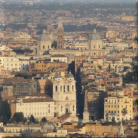
Ancient Center (Forum, Capitoline, Colosseum)
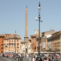
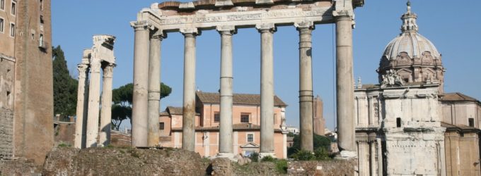
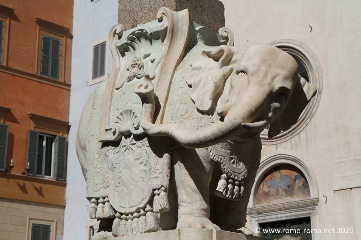
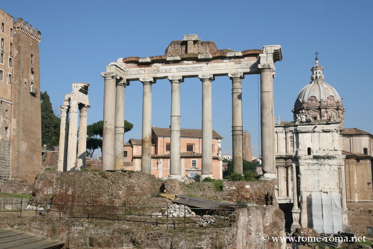
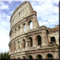 This area concentrates the greatest number of ancient relics. The Capitoline Hill, a sacred hill, overlooks the city with its elegant square and museums, overlooking the Forums stretching to the famous Colosseum. The Palatine Hill, legendary cradle of Rome, once housed imperial villas. Further south, near Piazza Venezia and the Vittoriano, the Forum Boarium runs along the Tiber up to the Mouth of Truth (see Ancient Center district).
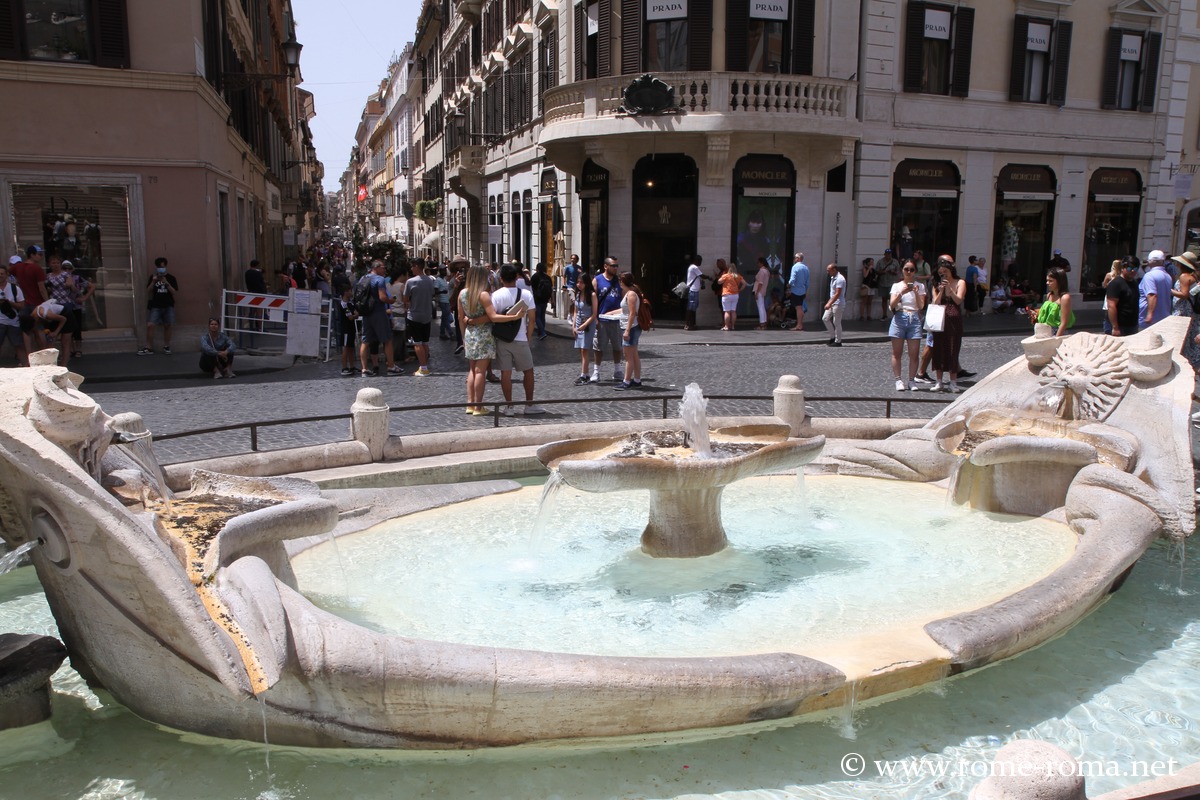
Campo Marzio and Ludovisi
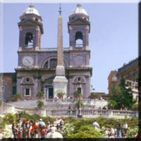 Once a military training ground, the Campo Marzio transformed into a central district north of the historic center, marked by Renaissance streets, palaces, and emblematic squares like Piazza del Popolo or the Spanish Steps. Overlooking it, Pincio and the Villa Borghese park offer a green sanctuary (see Campo Marzio, Villa Borghese and Ludovisi district).
Lateran and Esquiline
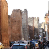
 Between the Caelian Hill and the Esquiline, this district houses the Basilica of St. John Lateran, the cathedral of Rome, and stretches along the Aurelian Walls to the Porta Maggiore. Further on, near the cosmopolitan Piazza Vittorio Emanuele, the Termini area buzzes with activity (see Lateran and Esquiline district).
Monti
The lively streets of the Monti district, spanning Esquiline, Oppius, and Viminal hills, pulsate with energy and attract tourists and Romans alike with a variety of bars and restaurants. Once a popular area of ancient Subura, it retains an authentic charm with its remarkable churches (see Monti district).
Esquiline with Termini and Repubblica
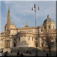 On the Esquiline, the Termini station area stands out for its cosmopolitan character. It hosts imposing monuments like the Basilica of St. Mary Major and the Baths of Diocletian, close to the modern Piazza della Repubblica and the Viminal Hill (see Termini district on the Esquiline and Castro Pretorio).
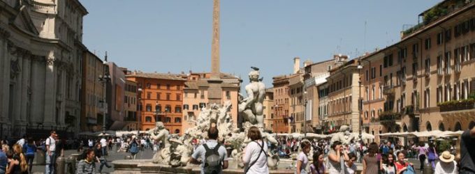
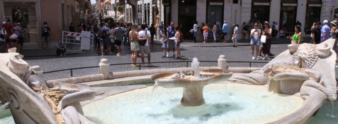
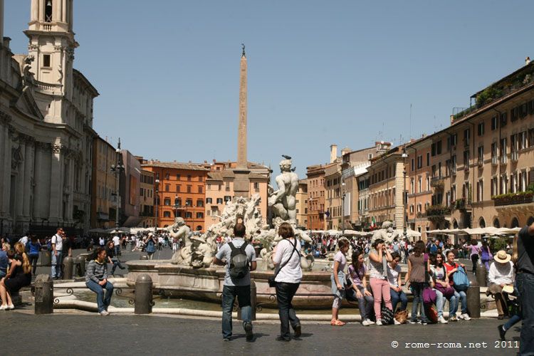
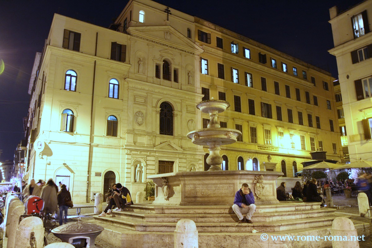
Navona and Pantheon
 This part of the historic center, rich in Renaissance, Baroque, and ancient treasures, captivates with emblematic squares such as Piazza Navona and the majestic Pantheon, which stands nearly intact from its origins. Wandering through its lively streets remains an unforgettable experience despite the tourist crowds (see around Navona district, Pantheon area).
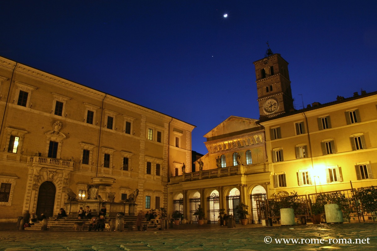
Trastevere and Janiculum
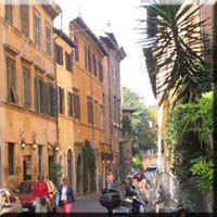 Across the Tiber, Trastevere retains a unique identity with its picturesque alleys, small squares, and welcoming restaurants—gaining popularity in recent years. Separated by Viale Trastevere, the district extends to the Janiculum Hill, renowned for its panoramic views over Rome (see Trastevere district, including the Janiculum).
Trevi and Quirinal
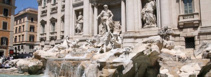
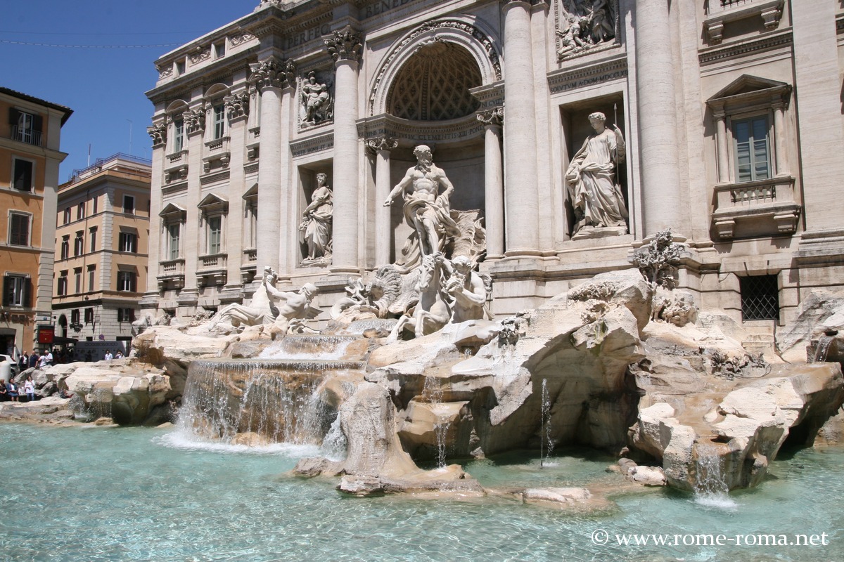
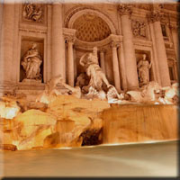 The Quirinal Hill, one of Rome’s founding seven hills, hosts the presidential palace and several churches. Below, museums, palaces, and shops surround the famous Trevi Fountain, a Baroque masterpiece and must-see Rome attraction (see Quirinal and Trevi district).
Neighborhoods Outside the Walls of Rome
Appia and Tuscolana
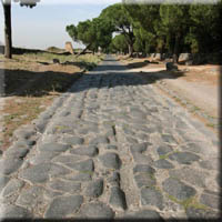 Explore a fascinating escape outside the walls of Rome with the Appian Way Archaeological Park, following this ancient Roman road for several kilometers. Discover the famous catacombs of the city and exceptional adjacent parks. Situated between the major avenues of Appia Nuova and Tuscolana, this modern neighborhood, developed in the 20th century, is home to the iconic studios of Cinecittà.
Pigneto and Prenestino
 Via Prenestina stretches from Porta Maggiore, first passing through the dynamic Pigneto district—a long-standing hub of nightlife, artists, and associations for over twenty years. Beyond, the residential and working-class areas of Prenestino and Centocelle, urbanized in the 20th century, offer an authentic local atmosphere.
San Lorenzo and Tiburtino
 Located near the Aurelian Walls and Termini station, San Lorenzo is a vibrant neighborhood, shaped by a popular anti-fascist culture and student life thanks to the Sapienza University. Bars, clubs, the historic basilica of Saint Lawrence Outside the Walls, and the Monumental Cemetery of Verano enrich this area.
Nomentana and Salaria
 Northeast of Rome, the ancient Salaria and Nomentana roads traverse residential neighborhoods. Discover the distinctive Art Nouveau district of Coppedè, the Villa Ada park, the Catacombs of Priscilla, as well as Villa Torlonia and the Saint Agnes Complex.
Flaminio, Olimpico, Parioli
 From Porta del Popolo, Via Flaminia follows the Tiber, crossing the modern district of Flaminio, with its museums and former industrial zones, as well as Pinciano and Parioli, known for embassies, Villa Borghese park, the Olympic Village, and the Auditorium.
Della Vittoria, Trionfale and Montemario
 Between the hill of Montemario, offering exceptional views and a nature reserve, and the Tiber, the Della Vittoria (formerly Milvio) district combines institutions and housing. To the north, the Foro Italico houses sports facilities, including a football stadium and sites dating from the fascist period.
Monteverde, Portuense and Aurelia
On the Janiculum hill, west of Trastevere, Via Aurelia crossed the Aurelian Walls. Today, Monteverde Alto is an elegant neighborhood near the Villa Pamphilj park, while lower Monteverde and Via Portuense offer a livelier, more working-class atmosphere.
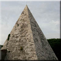
Ostiense, Ardeatino, EUR and Garbatella
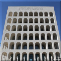 South of Rome, the ancient Roman road to the port of Ostia traverses historic industrial neighborhoods, passes by the Basilica of Saint Paul Outside the Walls and the charming residential district of Garbatella, before reaching the EUR, a planned urban area from the fascist era, with remarkable museums and architecture.


