 Tickets and visits for Ostia Antica
 Hotels, B&B and rooms near the monument
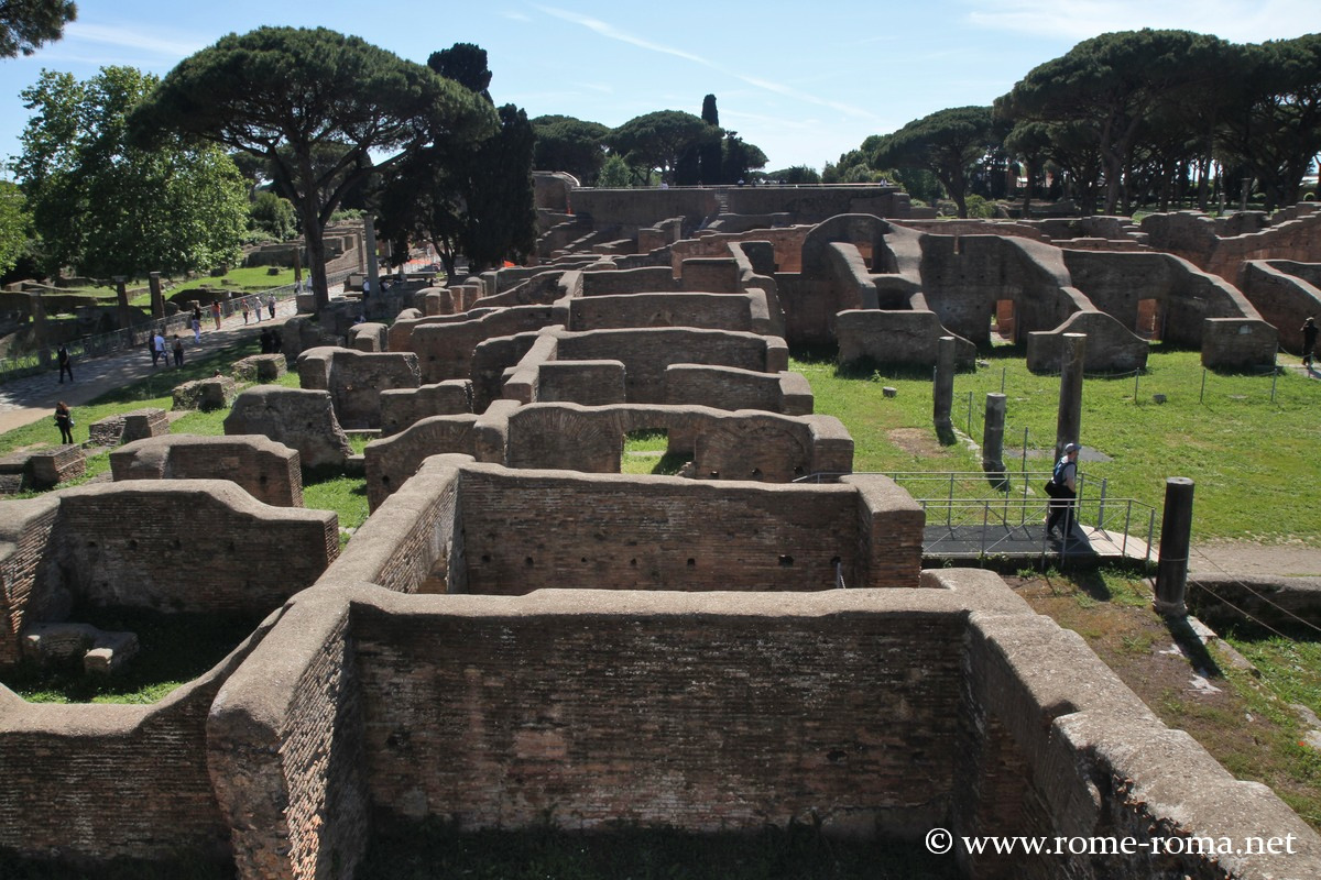
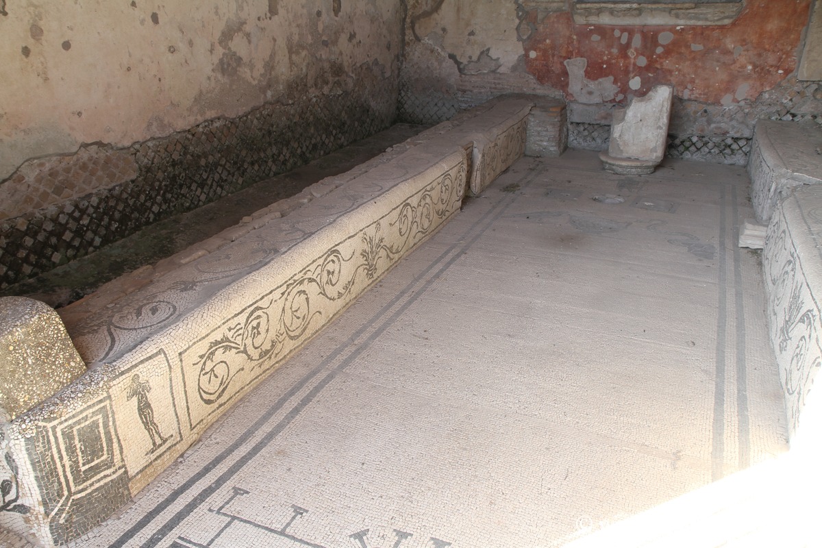
Houses around the Baths of Neptune
Ancient Ostia is a fascinating archaeological site about 20 km from Rome, and its visit is well worth it.
The tranquility of the place and its reasonable number of visitors make it a welcome break from the noisy city of Rome.
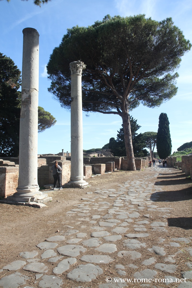
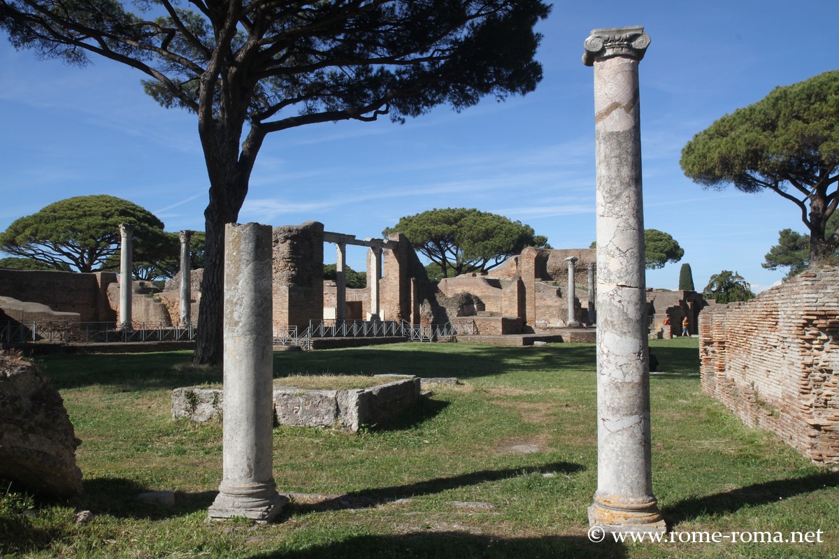
Near the ancient mouth of the Tiber, Ostia Antica is one of the largest and best-preserved archaeological sites of ancient Rome. Once a commercial port of the capital with up to 50,000 inhabitants, the city offers a rare testimony of Roman urban planning, with its streets, squares, baths, temples, shops, housing, and port infrastructure.
Over the centuries, as the coastline receded due to sedimentation, Ancient Ostia is now located about 2 kilometers from the shore.
To discover in Ostia Antica
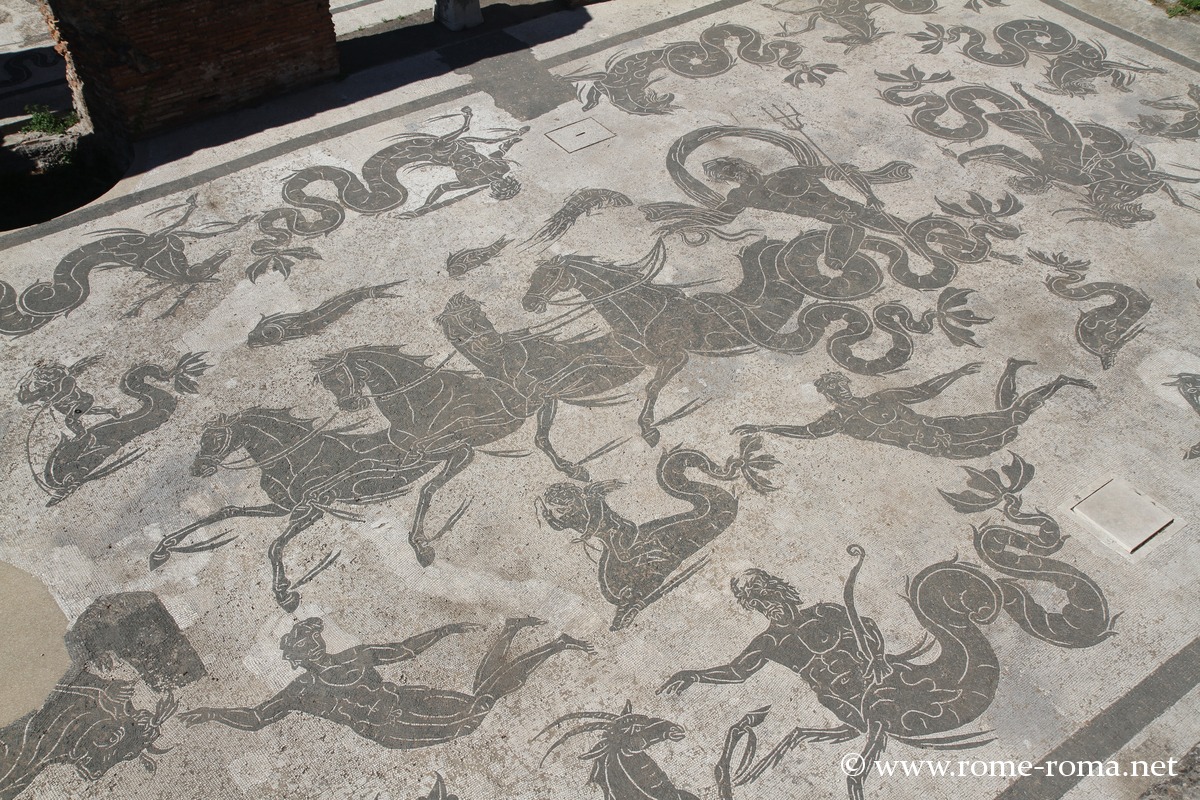
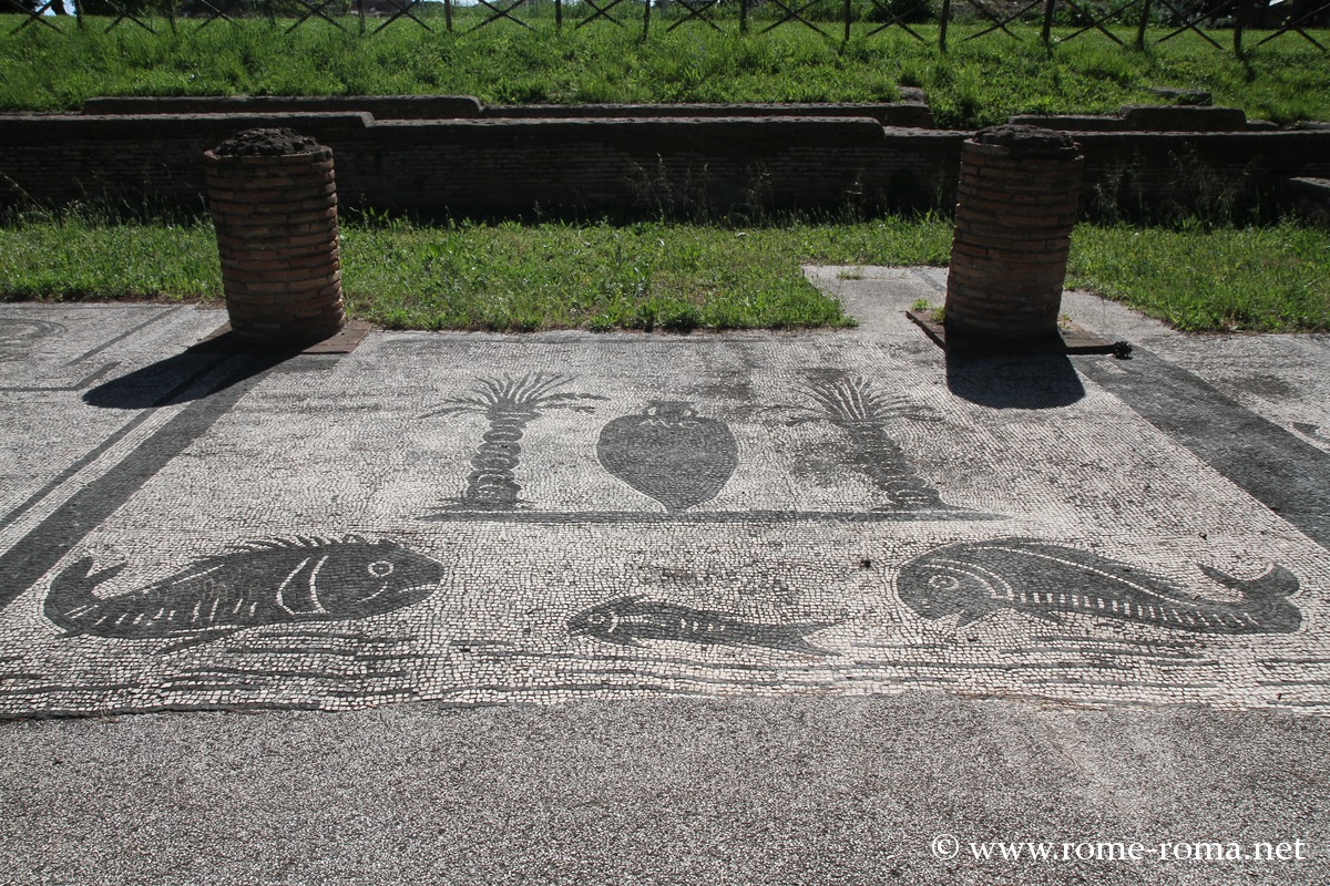
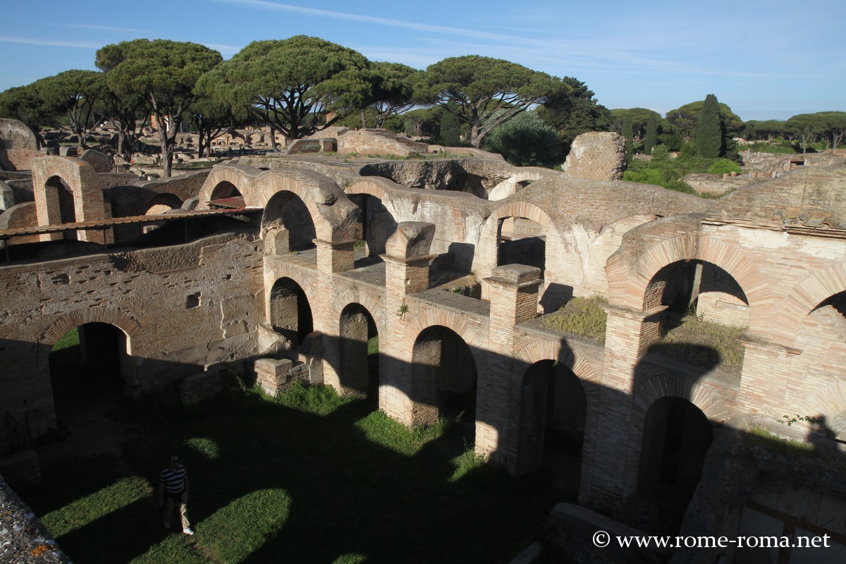
Following the Decumanus Maximus, the main axis of the city, one reaches several of its most notable monuments, starting with the Baths of Neptune, famous for their large marine mosaics.
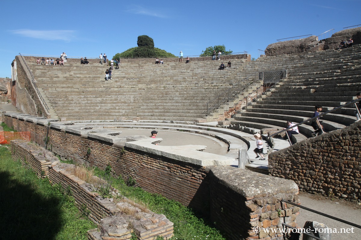
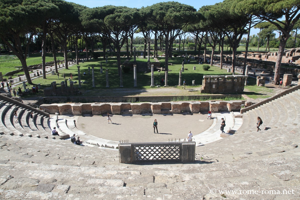
Further on, the Theatre dates back to the 1st century BC and was enlarged during the reign of Commodus. It could accommodate around 4,000 spectators and is still used for modern performances.
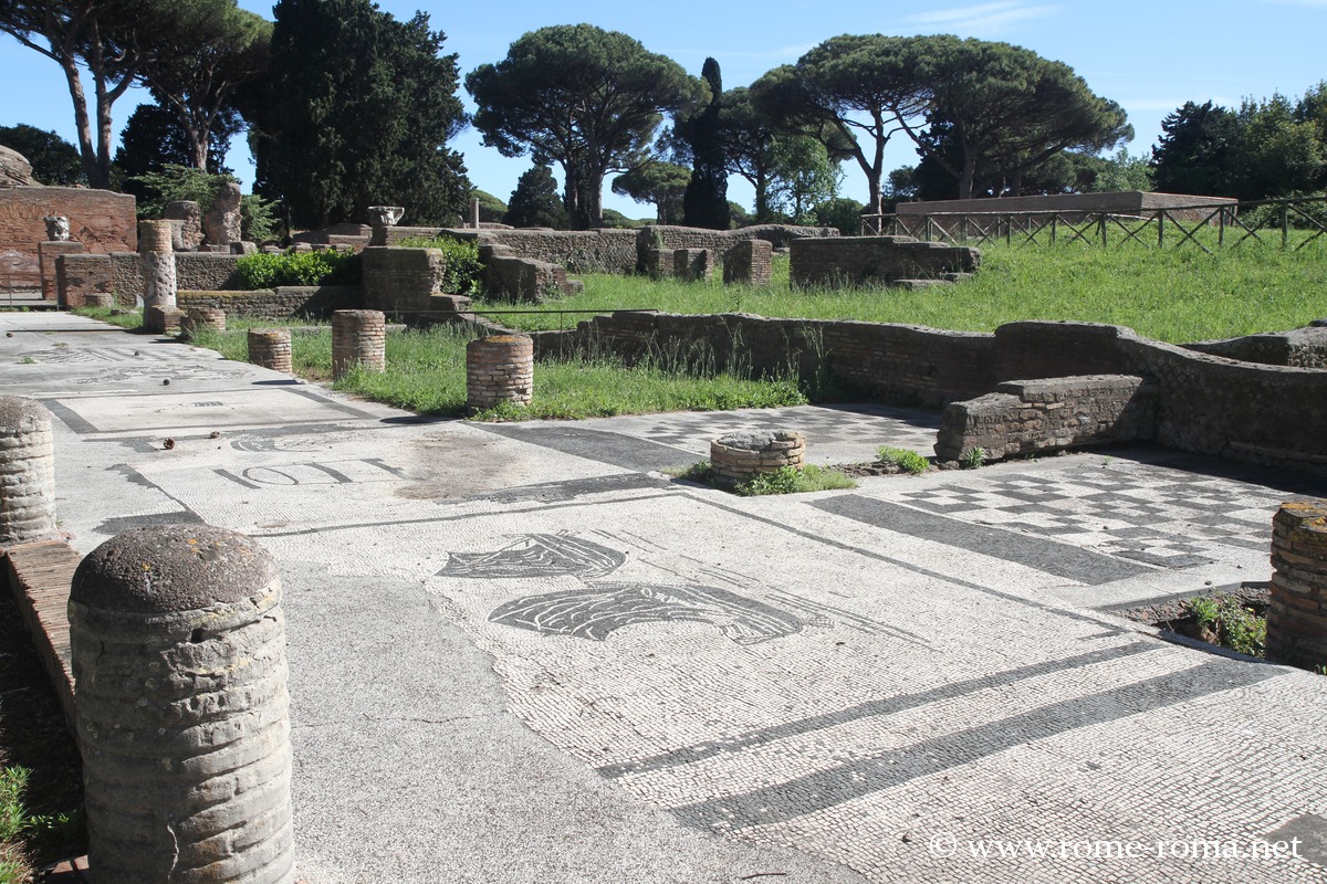
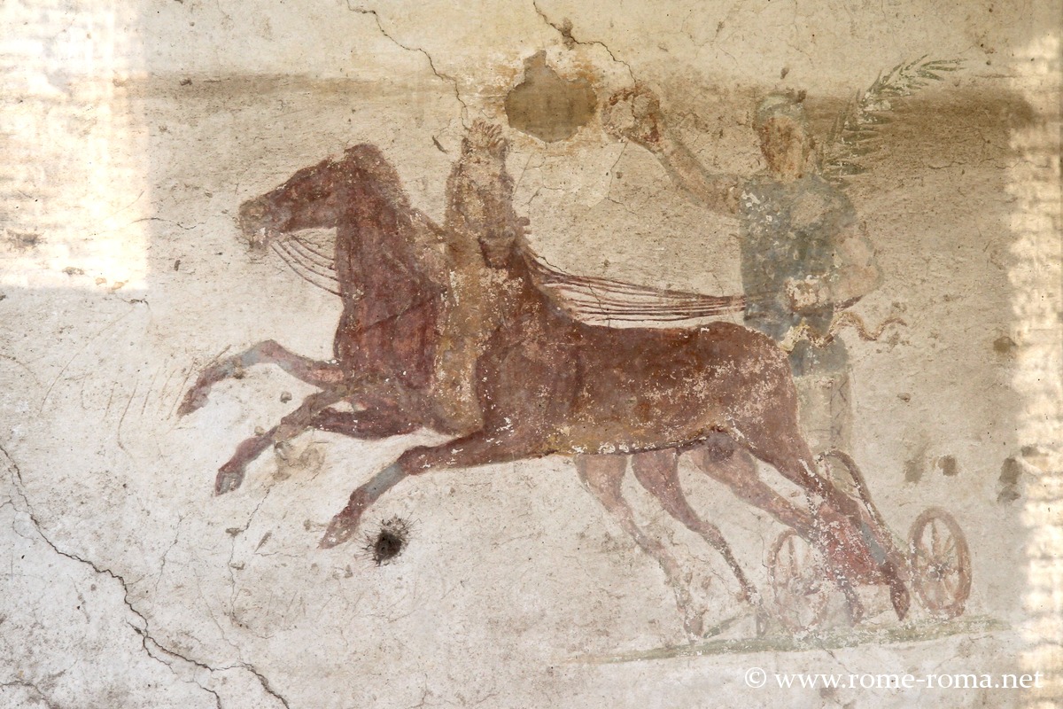
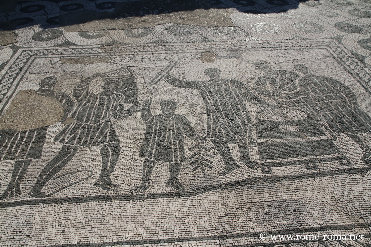
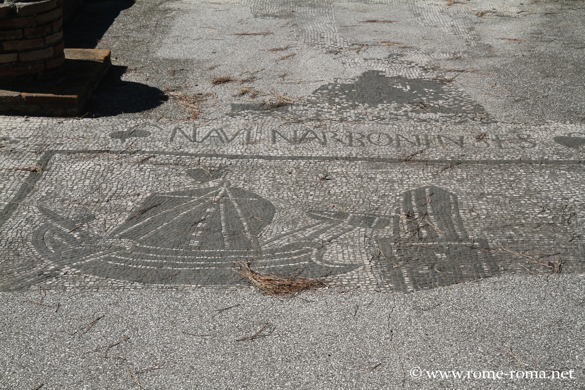
Behind the theatre stretches the Square of the Corporations, a vast rectangular area lined with porticoes, which served as a commercial centre and the headquarters of maritime guilds. The black and white mosaics, still visible on the ground, indicate the geographical origins or specialities of the different merchants (Africa, Sardinia, Narbonne, grain trade, wine, etc.).
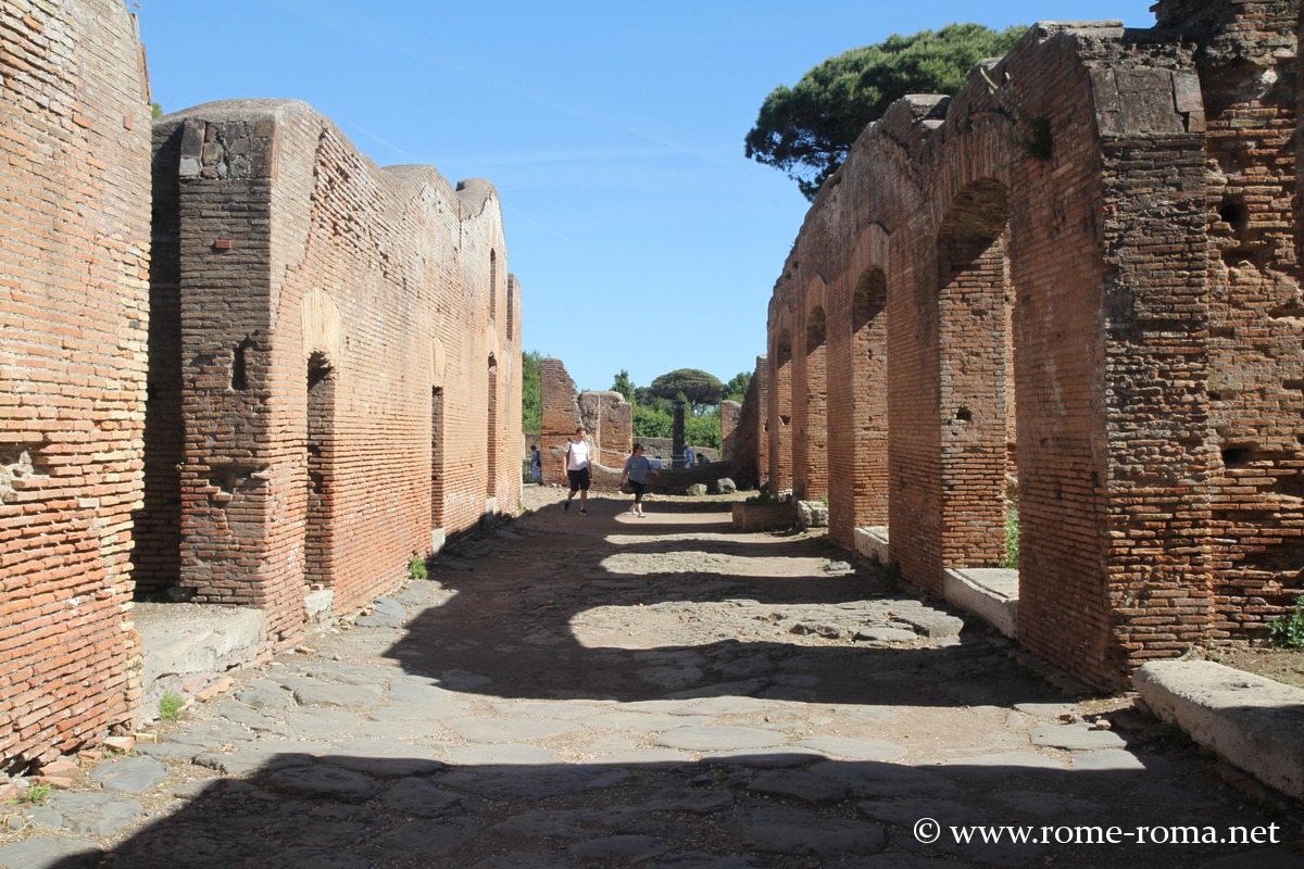
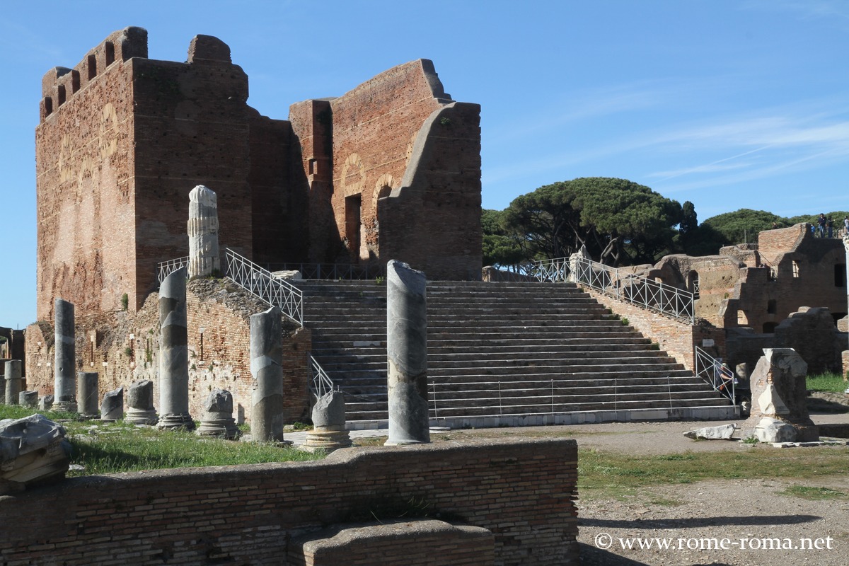
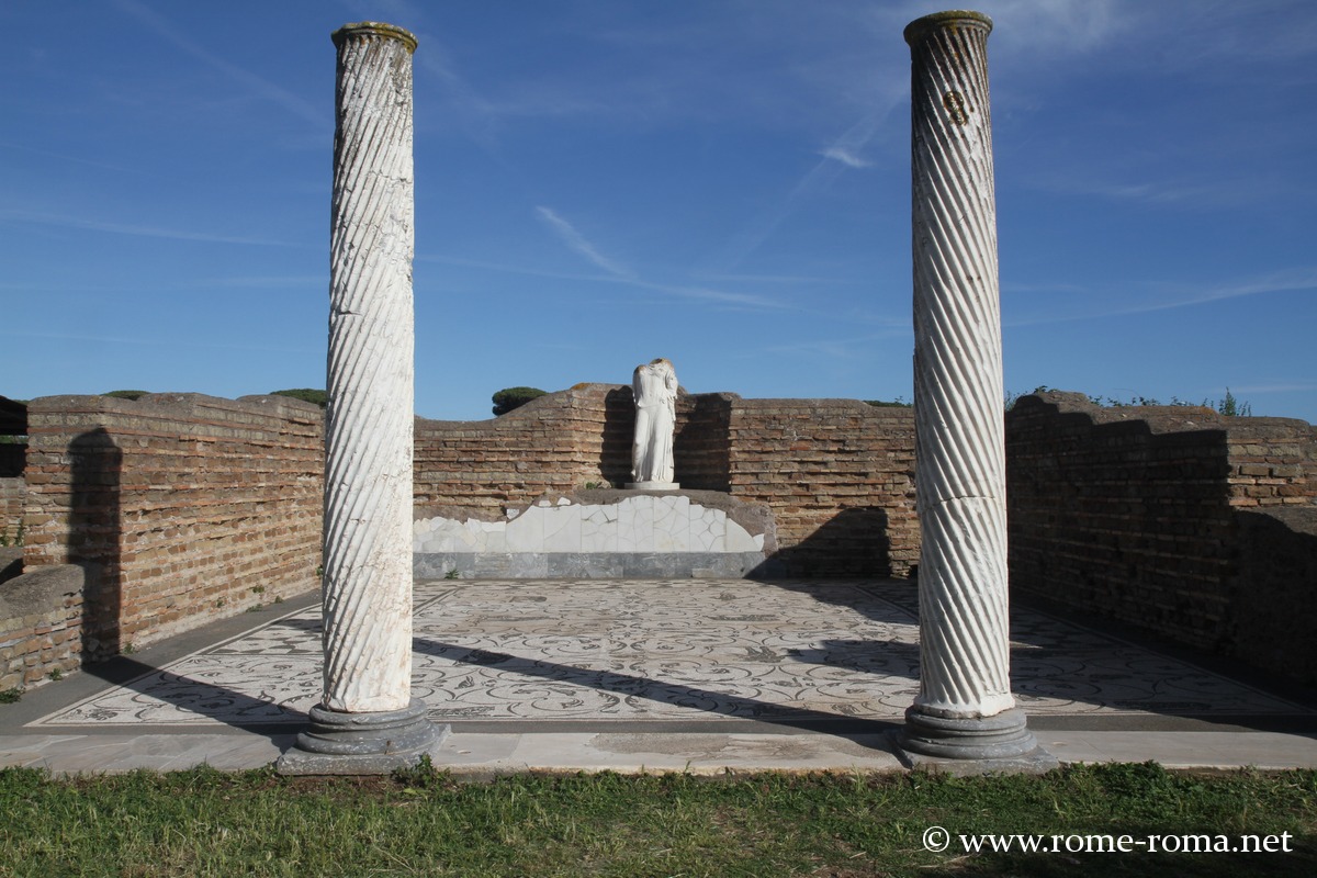
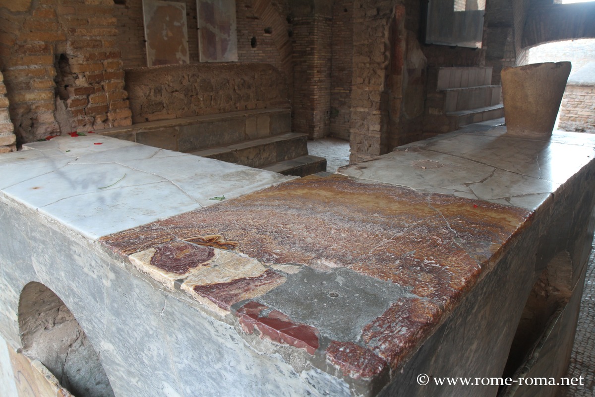
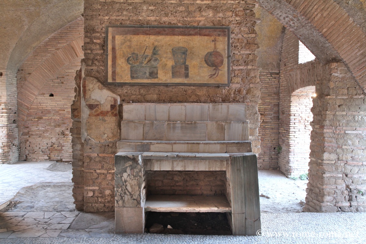
Among other notable buildings, the Forum Baths are well preserved, as is the Capitoline Hill, the main temple of the city located on an elevated platform. Several insulae (apartment buildings) remain, including the House of Diana, which has retained several floors. Numerous tabernae (shops) line the streets, sometimes decorated with frescoes, mosaic signs, or masonry counters.
The Forum, the political and religious center, includes the remains of the Basilica, temples dedicated to Rome and Augustus, and altars. On the outskirts of the site, it is also possible to visit the Ostia Synagogue, the oldest in the entire Western world.
Information: Hours and Visits
Viale dei Romagnoli, 717 / 00119 Ostia antica – Rome
| ||||
Hours and Prices (2024)
| ||||
Sources and links for further information |
History of Ostia, the Ancient Port of Rome
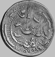
Roman coin from Ostia under Nero
The Early Days of Ostia, a Roman Colony
An ancient history, told by Titus Livius, attributes the founding of the city to Rome’s fourth king, Ancus Marcius, probably linked to the exploitation of the salt marshes in the area.
However, the earliest known remains date from the 4th century BC, with a castrum, a fortified military camp, identified in the center of Ostia, a rectangle approximately 194 by 125 meters with walls made of tuff blocks. According to Titus Livius and other sources, this was the first Latin Roman colony with the status of colonia civium Romanorum. Tradition then speaks of the first 300 citizens.
The roads crossed there perpendicularly and were preserved in the city center under the empire. This orthogonal layout, inspired by the cardo and the decumanus, remains visible in the current ruins’ plan.
Development of Ostia and First Port
The city developed rapidly during the time of Sulla (late 2nd – early 1st century BC) with a new much larger enclosure dated to 87-82 BC, built in opus quadratum blocks.
Under Augustus, large monuments were built, including the theater (the first dates back to Agrippa in 18 BC) and the large Place of the Corporations (Piazzale delle Corporazioni), which was redesigned under the Severans.
Under Tiberius or Caligula, the city was supplied by an aqueduct and baths were built.
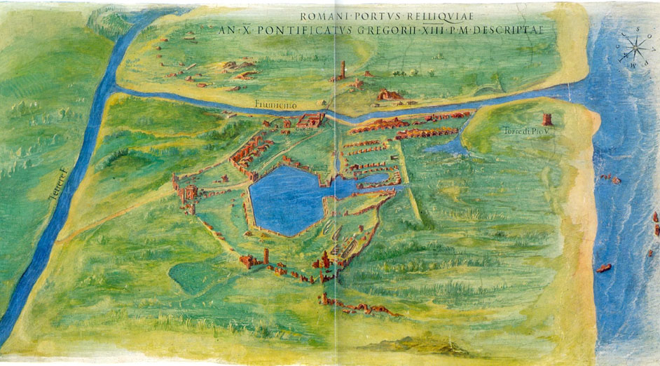
The emperor Claudius (41-54 AD) constructed a first port north of the Tiber’s mouth, the Portus Claudii, equipped with two moles and a lighthouse; now partially submerged. Here, goods from across the Empire arrived and were then transported up the Tiber to Rome on smaller boats.
The Peak of Ostia under Trajan and Hadrian
It was in the 2nd century that Ostia reached its greatest development, under Trajan and Hadrian.
Trajan built a new port, better protected than that of Claudius, to meet Rome’s significant needs. This Portus Traiani or Hexagonal Basin, was inaugurated around 112 AD. Commercial activity multiplied in the city, thanks to its role as a logistical center and warehouses for supplying Rome with grain, oil, and wine.
At that time, the Curia, the Forum basilica, numerous large warehouses (horrea), baths, and many houses were built.
With Hadrian (117-138 AD), the Piazza del Foro was developed along with the large Capitoline, rebuilding the Temple dedicated to Jupiter, Juno, and Minerva, reconstructed under Hadrian.
Districts were built, including the warehouse area near the Tiber, the Neptune baths, etc.
Many sanctuaries were constructed, notably spreading cults from the eastern part of the Empire, such as the temples of Mithras, Isis, and Cybele.
Decline and Abandonment
In the mid-3rd century, a crisis led to the abandonment of some public buildings, linked to political instability, invasions, and the decline of Mediterranean trade.
After some recovery towards the end of the 4th century, decline intensified in the 5th century, with port activities gradually transferred to Portus, marginalizing Ostia.
With the Vandal invasion of 455, the city was greatly depopulated. It seems abandonment then progressed gradually until the city was definitively emptied by the 9th century. In the Middle Ages, there was a fortified medieval village around the castle of Giulio II (15th century), but the ancient site was buried under alluvium.
Articles about Ostia
Map and address
Address : Viale dei Romagnoli, 717, Ostia Antica, 00119 Roma RMIf you see this after your page is loaded completely, leafletJS files are missing.


